Showing posts with label Guernsey. Show all posts

Saturday, October 03, 2015

Autumn on Herm

Herm, is a delightful island, which lies several miles to the east of Guernsey across an interesting section of water, the Little Russel.  Today is almost perfect conditions we were able to explore, not just the coast of Herm but the fascinating reefs to the north.  A memorable paddle for the beginning of October.
 Jim just off La Rosiere Steps on Herm.  Once we arrived here we knew that we were out of the strongest tidal flow and we could relax to a certain extent.
 Lunch spot on the north east corner of Herm.
 Laurie off Shell Beach.  The Humps are visible to the north.  It is hard to believe that it is the fist weekend in October with conditions like this.
Approaching Godin. This small island is the largest  of the Humps, a fascinating area to explore to the north of Herm.
There are plenty of distinctive navigation beacons around Guernsey and Tautenay is no exception.  It provided a convenient resting place whilst crossing the Little Russel, back to Bordeaux.

Sunday, February 22, 2015

Daily Picture - 52

Great view of Lihou Island, just off the west coast of Guernsey as we flew north towards Exeter this morning.  Scene of many great sea kayaking days and looking forward to another weekend paddling there with the Jersey Canoe Club in June.

Wednesday, January 21, 2015

Interesting tidal flows - Tidal Diamonds

In the early 2000's Chris Jones and myself ran the Sea Paddler website.  At the time it was very popular although nowhere as technically advanced as present sites.  We updated it regularly over the years, at least weekly, so there were literally hundreds of articles and thousands of pictures.  I may post some of the more relevant ones over the coming months.

Tidal diamonds are invaluable sources of information in relation to the speed and direction of tidal streams.  Whilst away on a paddling trip recently I came across, what must be an almost unique diamond?  It is diamond C on Admiralty Chart 808, East Guernsey, Herm and Sark.

49°27.5 N
2°31.4 W
Hours
Dir
Rate (kn)
  Sp           Np
-6
-5
-4
-3
-2
-1

HW

+1
+2
+3
+4
+5
+6
213
213
213
213
033
033

033

033
033
033
213
213
213
5.1            2.2
4.1            1.8
2.7            1.2
1.2            0.5
1.2            0.5
3.9            1.7

5.2                  2.2

 4.9            2.1
 3.3            1.4
 1.5            0.5
 1.3            0.5
 4.0            1.7
 5.2            2.2

The first observation is that the streams only flow in two directions, exactly opposite each other.  The tide is flowing approximately SSW and then it changes abruptly and goes NNE.  An exact 180° change.
Something else to note is that maximum rate occurs at high and low water, with slack, if it can be called that, occurring at mid tide.  Many a sea paddler or other water user has been caught unawares because they assume that maximum rate must occur at mid tide and have set out on what they thought was high water slack.
The advice is to always double check your data and to keep your eyes open for interesting and possibly unique items of information as shown by this tidal diamond.
The location of the diamond is in line with the two towers on the photograph and to the right of Brehon Tower, which is in the middle of the channel between Guernsey and Herm, the Little Russel.

Wednesday, November 05, 2014

Channel Island Sea Kayaking

A few pictures of sea kayaking around the Channel Islands, mostly from about 30 years ago or slightly older.  The difference in shape of the images is because the earlier ones were taken with a Kodak Instamatic camera (remember those?) before I had a job which paid enough money to be able to buy a 35mm camera.
In all the time that we spent paddling around the Channel Islands in the 1970's and 80's I don't think we ever bumped into any other sea kayakers, it really did feel like an era of exploration.
 This is returning to Jersey (visible behind the paddlers) from Sark in June 1979.  Note the old style hatches.
 Another image from the Sark paddle in 1979, in those days the only sea kayak which we considered having was a Nordkapp HM.  If you could afford it you had Lendal Nordkapp paddles with wooden blades, if not you just used your standard Wild Water paddles.
 Heading north from Jersey, the island is Sark, which was our original destination but we changed part of the way across and decided to go to Guernsey instead.  The paddler is Derek Hairon who now runs Jersey Kayak Adventures.
 Arrival at Bordeaux in Guernsey on our day trip from Jersey.  What had planned to be a gentle paddle turned into a 40 nautical mile day trip.  In the distance can be seen Herm (left), Jethou (right) and Sark just visible between the two.  On the return journey we stopped off at Herm to phone through to our parents to let them know that we were going to be late home and the telephone box still had buttons A and B to press.
The summer of 1982, I was getting married and so distant holidays were out of the question but we had a great two weeks paddling around the Channel Islands.  This is Port au Moulin on the west coast of Sark in August 1982.
Havre Gosselin, on the west coast of Sark  This was on an Advanced Sea Assessment in May 1983.  The Nordkapp HM still dominated the kayaks in use in the Channel Islands.  This photograph was used on the front cover of Canoeist Magazine.
 Leaving Creux Harbour, Sark in December 1983.  We left Greve de Lecq, on the north coast of Jersey,  in the dark and crossed the 12 nautical miles to Sark.  The idea was to purchase duty free drink for Christmas and we had a significant number of orders.  Unfortunately the shops were shut so that part of the paddle failed.  We did managed to find a toasted cheese sandwich before returning to Jersey and landing back at Greve in the dark.
 In the 1980's I was busy running lots of training and assessment courses for the BCU Senior Instructor Award.  This was December 1983 on the south coast of Guernsey.  The paddler in blue is Ron Moore, a superb coach and legendary speaker who was based in Plymouth, who is sadly no longer with us.
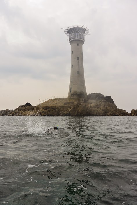
Another BCU training course in October 1984.  This is at Havelet, just south of St Peter Port.  Plastic kayaks had made an appearance, although Brian Aplin is still paddling what looks like a fibre glass KW7.  It was Brian who I accompanied on his swim a couple of months ago, from Lihou to the Hanois.
The Minquiers in September 1985.  We visited this reef to the south of Jersey as a day trip whilst training for the Canoe Club paddle we were planning for the following summer when we kayaked from Tromso to Honnigsvag, around Nordkapp.
In the 1980's I ran a canoeing (kayaking) school in Jersey but we used to do lots of trips away.  This is crossing from Guernsey to Herm in perfect conditions in July 1989.
 1989 saw the arrival of the Aleut II, designed a built by Howard Jeffs.  I still have this kayak.  It opened up a number of possibilities.  Pete Scott and myself attempted to paddle around the Channel Islands but it also meant that some people could undertake paddles that they might not have done on their own.  This is two of the younger Club members heading down the east coast of Sark in June 1990.
 I think this was still a Senior Instructor course, we hadn't quite become Level 3 coaches.  This is launching down the steep slipway in Saints Bay Guernsey in October 1990.  I was amazed that we survived all these courses because nobody had heard of risk assessments etc.  What I do remember was that there was always a huge element of fun.

Wednesday, October 01, 2014

Guensey's South Coast

Following Brian's epic swim to the Hanois we headed east towards Pleinmont Point, to meet the south coast of Guernsey and head towards St Peter Port.  The south coast of the island is spectacular and continuous.  There are very few places with easy access to the sea , so there is always a feeling of commitment when kayaking in this area.  
After a gap of a few years of paddling in this area it is pretty satisfying to have completed the south coast paddle twice in just over 8 weeks.  It is probably 2015 before another opportunity will occur.
 Arriving at the south coast, having crossed from the Hanois Lighthouse we reached the coast just to the west of L'Angle Tower.  Constructed by the German's it is one of the most impressive range finding towers in the Channel Islands and is unusual that it is rectangular as opposed to be round.
There is nearly always some interesting geology to be seen.
La Prevote Tower is another large fortification along this section of the coast.
 Just leaving Petit Pot after a quick lunch break.  This is probably the only place along the south coast where there is relatively easy access with a car, although parking is not always easy.  The tower is one of 15 which were built around Guernsey between August 1778 and March 1779, as a defence against possible French invasion.
 Approaching Icart Point
 
 Approaching the Pea Stacks, close to the south west corner of the island.  These are dissected by a number of channels and the height of the tide was ideal for exploration by kayak.  They were painted by Renoir in the summer of 1883, when he visited Guernsey.
 
 Heading through the channel between the Pea Stacks and the mainland.  The tidal flow, which was in our favour is just visible.
 Conditions remained ideal as we headed towards St Peter Port.  Just after taking this photograph we were graced with an encounter with some dolphins.  In contrast to the bottle nose dolphins that I have seen on many occasions off Jersey these were Risso's Dolphins.

Tuesday, September 09, 2014

A day on Lihou

Every day on Lihou is special but today was particularly so.  Sea kayaking in the morning, swimming and fishing in the afternoon and walking in the evening.
 Leaving the south side of Lihou in the morning, heading for the cafe at Portelet.  Lihou was part of the first designated RAMSAR sites in Guernsey.
 Happy paddlers with full stomachs heading back to the kayaks.  Lihou is the large island on the horizon.
 Heading north back to Lihou
 Lihou Priory was in existence by 1156, today it lies in ruins.
 The stones always look particularly warm in the late evening sunshine.
 The remains of the dove cot, part of the food source for the Priory
 The view south towards Pleinmont headland.  The Hanois light is just out of the picture to the right.
 Watching the tidal stream pour north through the gap between Lihou and Lihoumel.  3 hours earlier we had be able to scramble across the gap.  At this point we were people furthest west in the Channel Islands.
 Heading back towards the house for evening meal.

A swim to the Hanois

Off the south west corner of Guernsey is one of the classic lighthouses, the Hanois. We paddled out to the light in June this year, but sitting at Cobo last Saturday evening Brian Aplin explained that he had planned to swim from Lihou, out to the Hanois the following morning.  The aim was to use the southerly tidal stream to speed things along although care was needed not to be swept past the reef.
Launching from the causeway across to Lihou was probably the most challenging part of the day, the tide was dropping at quite a rate.  We joined up with Brian off the north west corner of Lihoumel and very quickly felt the impact of the tide.  Accelerating through the reefs but heading towards the Lighthouse.
Brian swam with just a couple of breaks to take on extra liquids.  On my GPS I measured the course as 2.18 nautical miles, taking him 1 hour 40 minutes to cover the distance.
I towed Brian's Nordkapp but when we arrived at the lighthouse there wasn't an easy option for him because we paddled a further 12 miles to St Peter Port.
 Joining up with Brian off the north west corner of Lihou.  He is just to the left of the closest rock.  The Hanois is barely visible in the distance.
Well under way.  Lihou is the large island on the horizon.  Brian swam in his crocs, they seemed ideal for this type of activity
 At this point I thought there was a possibility of missing the reef as the tide was pushing us south fairly quickly.  With the benefit of knowing how to ferry glide when swimming Brian did achieve the shelter of the reef.
 Almost there.  As far as we know nobody else has completed this remarkable swim.  What  a way to spend a Sunday morning.

Thursday, July 10, 2014

A Calm Hanois

I first paddled out to the Hanois in May 1981, located off the south west corner of Guernsey it seemed like a great adventure at the time.  A few years later I was running an Advanced Sea (5 Star nowadays) in the area and we were lucky enough to be invited into the lighthouse.  In fact we were given the opportunity to stand on the helicopter landing pad.  That was an interesting experience!
Sadly those days have gone as the lighthouse was automated in 1996.  It is still a fascinating place to paddle and well worth the effort if you are visiting Guernsey.  Most years though the sea has been far too rough to approach the reef, let alone land, so it felt quite special as we wandered over and through the reef. 
Although granite from Guernsey has been exported for hundreds of years, for example Blackfriars Bridge in London was repaved with Guernsey granite in 1840, with London Bridge and the Strand following a few years later, the Hanois Lighthouse was built with granite imported from Cornwall.  The stone was dressed on the harbour in St Peter Port before being transported around to the south west corner of the island.  The work took nearly 2 years and the light was first lit on the 8th December 1862.
Since that date it has warned shipping of the dangerous reefs to be found off the west coast of Guernsey.
Hanois Lighthouse viewed from the south east.  The helicopter landing pad is clearly visible.  The last few years we haven't been able to get this close whilst on our annual Lihou visit.
There were several places to land but we selected this sheltered location on the western side of the reef where it was possible to moor the kayaks.
Lying on my back with my feet against the lighthouse gave an unusual perspective.
Paul, who had landed here a couple of days earlier decided to spend his time exploring the reef as opposed to the lighthouse.
Looking back through the reef towards Lihou, clearly visible through the gap in the rocks.
Paul was kind enough to bring some Tiderace kayaks over for people to try.  The paddle out to the Hanois was an ideal opportunity to see how they handled.

Tuesday, July 08, 2014

Around Guernsey

Over the last 7 or 8 years we have visited Lihou, off the west coast of Guernsey on a regular basis, normally at least twice a year.  Amazingly every time I appear to have visited this delightful corner of the Baliwick of Guernsey the wind has being blowing particularly hard.  It has not been uncommon to have force 6-8 with a big swell.
It was somewhat surprising then when looking at the forecast about 7 days in advance, there appeared to be a weather window developing over the western English Channel.  As high pressure settled in the swell and wind died off and it looked like we were in for a perfect weekend.
My plan of paddling around Guernsey from Lihou seemed to be working and the tidal flows were such that lunch on Herm also seemed like a distinct possibility.  Plans were hatched, departure times agreed and expectations raised.
In the morning we launched from Lihou and headed south towards Pleinmont headland and then the south coast of Guernsey.  It had been a few years since I had paddled the south coast in its entirety and what a great stretch of coast it is.  Beautiful cliffs, intriguing passages through the rocks, limited landings and very little other boat traffic.
It was also possible to paddle across to Herm, one of the most peaceful of the Channel Islands, for lunch and liquid refreshment at the Mermaid Tavern before returning to Guernsey to complete the circumnavigation of the island.
A memorable day out.
As elsewhere in the Channel Islands there is plenty of evidence of the German Occupation during the Second World War.  L'Angle Tower is an iconic feature overlooking the south coast was built as a direction-finding tower.
Further shots of the south coast.
The Pea Stacks are always an interesting place to explore.  The last time I was here we were swimming in slightly rougher conditions.  Renoir visited Guernsey and painted these rocks.
St Martin's Point, the most south easterly point of Guernsey.  It marked the start of the 4 mile crossing to Jethou.
Approaching Jethou, with Herm behind.  We could almost smell the food at the Mermaid Tavern.  Crossing between the two islands there were 20 plus puffins bobbing around on the water.
On a day as sunny as this it was inevitable that the harbour at Herm would be a hive of activity.  Numerous ferries and private boats completing the short crossing between here and Guernsey.
Fed and watered we started the crossing to Guernsey.  It was only a neap tide but the current was flowing north, reaching 4 knots in places.  Sea kayaking in the Little Russel is always entertaining.
Ice cream stop on the north coast of Guernsey.
Heading down the west coast of Guernsey.  A flag is hoisted on this rock, off Cobo, every year and left in place until the following May
We arrived back at Lihou, 25 nautical miles completed, satisfied with one of the more memorable paddles for a few years.  It was Pimm's on the terrace followed by a stunning sunset.