Wednesday, March 30, 2011

Greek Sea Kayaking Again

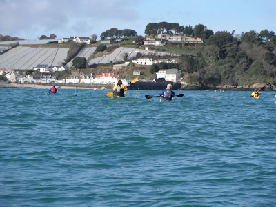
As temperatures in the Mediterranean start to rise (hopefully) it is time to head south again. This evening we had a useful meeting planning for our trip next week when we aim to kayak from Milos to Santorini and back. If all goes to plan and the weather is on our side then we should spend at least one night on each of the islands marked below.


Packing at Pollonia on a previous visit. Hopefully our departure point next weekend.
The lighthouse bay. This should be our first camp site and the start point for our crossing the following morning.

If you haven't experienced sea kayaking in Greece before then consider it for this year, you won't regret it. We have our fingers crossed for the end of next week.

Tuesday, March 29, 2011

Stand up Paddleboard

To take advantage of the first week day evening after the clocks switched to British Summer Time, we headed down to Petit Port, a reef break just to the north of Corbiere, to take play on the swell.  My paddling partner was Chester from Absolute Jersey who is considerably more competent than me, its always good to know that there will be somebody looking out for you!
It was only my third go on a SUP but I feel that as sea kayaker I have a number of the skills necessary to control the board, for example, being able to J-stroke but I lack the ability to move my feet around with any degree of confidence.  Its something to work on.
I did manage to catch a number of waves but next time I head out on the boards it might be better to choose a non-surfing venue and get some miles in.

Paddling out at the start of the session.  The breaking wave at the front is the normal Petit Port break, used by surfers when the tide is higher.

 Climbing back on after catching the previous wave.  I didn't make it through the break!

If you haven't tried stand up paddleboarding then look for an opportunity  during the coming months.  It is great fun and surprisingly hard work.  An hour on the board seems to be much harder work than an hour in the gym and its certainly a more pleasant environment in which to train.

Sunday, March 27, 2011

Gourmet Sea Kayaking

Once a month during the winter season the Jersey Canoe Club arranges a gourmet paddle, by sea kayak, to a local pub for Saturday lunch. Living on an island it is always possible to find somewhere with suitable water conditions and a welcoming eating house. Although we don't always need an excuse it is a great reason to get on the water. Conditions do vary though as shown by last winters offering.

Rounding St Catherines Breakwater, we crossed Fliquet Bay, heading towards the north east corner of the island. The white building is one of the earliest Jersey Round Tower's probably built between 1781 and 1787.
Once on the north coast it was necessary to pass the small harbour at Rozel. Its small pier built in 1829 to take the over spill of oyster fishing boats which couldn't be accommodated at Gorey.

O.K. I know that James Bond did it first but I have always wanted to arrive on a beach and remove my dry suit to reveal a slightly higher standard of dress than what is normally associated with kayakers.
The Black Dog at Bouley Bay was the selected eating house. A great lunch was enjoyed by all.
The return to St Catherines was assisted by a gentle westerly wind. Tour de Rozel which is one of the most popular tidal races on the island with sea kayakers was reasonable quiet today.

This is the second year that we have run the winter sea kayaking and eating season and I am certain that it won't be the last.

Saturday, March 26, 2011

Advanced Sea Kayaking

Searching through some of my sea kayaking literature this week I came across a small booklet which described all of the British Canoe Union Tests and Awards. What was particularly interesting was how the top level personal award in sea kayaking has changed over the last 40 years. Download the BCU 5 Star Award and see how the scheme has evolved.

Advanced Sea Test - - - Kayak only

The purpose of this test is to ensure that the successful candidate has sufficient knowledge and skill to take parties on advanced sea journeys with safety. He must give evidence (e.g. log book) to satisfy the examiner that he has taken part in at least eight advanced trips, and have assisted the leader on two of these. He must already hold the Sea Proficiency Certificate, which he will produce at the time of testing. The test will be conducted on the sea in an advanced situation.
The candidate will : -
1. Pack his canoe for a one day sea trip, including the following items : -
spare clothing, repair kit, packed lunch, equipment for preparing a hot drink. emergency
food, flares, whistle, first aid, torch, matches or lighter, polythene bag of minimum size 6' x
3' for use in case of exposure, compass.
2. Demonstrate advanced surfing techniques: i.e. manoeuvring on waves forwards, sideways
and backwards; rolling under breaking waves.
3. Demonstrate and take charge of, with partners, a deep water rescue and an Eskimo rescue.
4. Demonstrate an approved method of resuscitation.
5. Answer questions on the the following, with the aid of a chart if necessary : -
a. Repairs and maintenance
b. The causes of tides and tidal streams, and how to allow for them.
c. The use of transits, taking bearings on known features and the use of the compass.
d. Sea conditions and the effects of wind, particularly on :-
(1) Shelving bottom (2) Lee shore
(3) Rips (4) Overfalls
(5) Tide races
e. Weather forecasting from observation of cloud formations, and the means of
obtaining, and understanding, weather forecasts.
f. Group leadership and control
g. Estuary canoeing
h. Types of canoe and equipment
i. General canoeing knowledge including competition.
6. Plan a sea canoeing expedition of two to three day's duration, in detail, from
an unfamiliar chart in conjunction with the pilot book and tide tables.

January 1971

This is one the earliest photos that I have scanned in from the early years of my paddling career. Derek Hairon at the Ecrehous, our first trip on the August Bank Holiday weekend 1974. For us this was the era of home made kayaks and paddles, BS3595 lifejackets and using empty water containers as buoyancy for the kayak. Although commercially available sea kayaks were coming onto the market they hadn't reached Britain's South Sea Island (Jersey), so in 1974 we were still paddling our modified KW 7's. A few years later I took my Advanced Sea at Bardsey with Ray Rowe and I was still paddling a GP kayak. How things have changed I don't think I paddled a GP kayak once last year.

Friday, March 25, 2011

Coasteering Starts

Sea kayaking was off the menu today as we took advantage of the warm weather for the first coasteering session of the season. Gorselands on the south coast of Jersey was selected as the south facing granite cliffs capture the heat more than almost anywhere else on the island.

After the first swim is was a welcome relief to scramble over some rocks to the next jumps. As soon as I hit the water I regreted leaving the neoprene gloves in the car.
Early in the season we mainly stuck with the lower jumps as our technique was somewhat rusty.
The helmets helped to prevent severe ice cream head. Pete didn't suffer at all as he was the only member of the group with a neoprene hood.
A simple swim across the gully before scrambling around the headland to the next jumping location.
Scrambling along to the jumping spot. Corbiere lighthouse is behind and to the right of the jumpers. The anticipated sunshine hadn't materialized at this point.
This is one of the safest low water jumps on the south coast. The flat topped rock provides a safe jumping platform and the water is deep. From here it was a simple swim across the bay and a scramble up the cliffs to the cars.

It was good to get in the water again after the winter months but the sea temperature has a long way to go before we are able to comfortably spend several hours exploring the stunning Jersey coastline at sea level.

Thursday, March 24, 2011

Sea Kayak Navigation

This winters sea kayaking navigation courses have proved really popular with local paddlers. The Coastal Navigation and Tidal Planning, which is a pre-requisite for the 4 Star (Sea) was run in January and this has been followed by the Open Water Navigation and Tidal Planning.
The more advanced course is more appropriate to many local kayakers because as soon as we head offshore towards the local reefs it is necessary to be able to allow for, at times, significant tidal drift. Laying off a course is second nature to many local sea kayakers.
Completing the courses this early in the year means that many more people are prepared for the months ahead. It is interesting that I have been running navigation classes for about 20 years but it is only in the last few that the participants have been able to receive something concrete for their endeavours. So thanks to the British Canoe Union for introducing the awards.

Paul and John half way between Herm and Alderney
Kim and Dom heading towards the French Channel Island of Chausey. It necessary to stop off on the Minquiers on the way south.
Some of the group discussing their trip, and the lessons learned, when they went to the Ecrehous on the large spring tide the weekend before.

Wednesday, March 23, 2011

The Last Invasion of the British Isles?

As regular readers will know my favourite sea kayaking trip is to the Ecrehous, a delightful reef to the north east of Jersey. Last weekend we were fortunate enough to visit the islands on the large spring tide and had access to one of the huts for the evening. Reading through an old visitors book there was a recording of the events which unfolded during what is possibly the "last invasion of the British Isles".
In 1993 a group of French fishermen landed on the reef and pulled down the Union Flag, which flies when people are in residence on the reef. It flies over the southern end of La Marmotiere.

Information was received that in 1994 a large "invasion" was planned but this time the Jersey police were ready to protect the sovereignty of the reef. The events of the day are recorded in the visitors book by the Police officers who were on the reef.


The log records the following activity during the day:
9th July 1994

Pc 188 (.......... ..........)
Psgt 161 (....... ............)
Police HQ, 24, States of Jersey Police Officers and St Martins Honorary Police landed at 06.00 in response to threat from French fishermen of a mass planned demonstration by extension of Jersey territorial waters. 09.30 hrs first boat with demonstrators arrived. 10.30 hrs 6 large fishing boats arrived with 100 demonstrators including 12 right wing activists. 11.30 mass with French Priest held on the stone beach, demonstration urged to take action to lay claim to Les Ecrehous. 13.00 fight between two fishermen at the official flag pole was dealt with by Police. Reinforcements - further 12 officers shipped in. A very welcome sight - a calming influence to see the Duchess and two rigid raiders. All demonstrators left on good terms with the community and Police Scene Commander Supt Jones ordered stand down at 19.00. Two officers left on the island overnight.

The Priest and some of the crowds on the shingle bank. (Apologies I have been unable to discover the photographer)
The Ecrehous as they should be seen, peaceful with clear waters and interesting tidal flows.

It is easy to see why some French would want to take over the sovereignty of the Ecrehous but the International Court of Justice ruled in favour of Jersey on the 17th November 1953. It would be interesting to find out if there has been a more recent "invasion" of the British Isles.

Tuesday, March 22, 2011

A Very Big Tide

Another weekend with light winds meant a possible visit to the Ecrehous by sea kayak but as it was one of the highest tides of the year an overnight stay was favourite. In the channel between Jersey and the reef the tidal streams reach speeds of over 5 knots, unfortunately not in the direction we wanted to head.
It was important to take advantage of the short tidal window for the crossing and to be prepared for the change in direction of the tidal flow. The speed at which it picked up was surprising so the last couple of miles into the reef were slightly more challenging than anticipated. After a mile of ferry gliding across overfalls in the dark we were pleased to touch dry land, although as it was high water there wasn't much of it left.
We had the reef to ourselves that night which was unusual as there are normally a number of other residents. A couple of beers later and a warm meal and we were set up for the night.

Nicky heading towards on the Saturday afternoon. Some barely visible white dots just in front of the kayak are all that could be seen of the main reef. Little did we realize that it would be dark by the time we arrived. The north going tide was running particularly fast and due to the size of the tide there were virtually no rocks uncovered which it was possible to shelter behind.The Sunday morning high tide left very little room for the kayaks but the high pressure depressed the level it reached. We did tie the kayaks to the building just in case a swell developed overnight.
A couple of hours later the sun had burnt off the cloud and the falling tide had exposed the shingle bank. At high water the tide runs with considerable speed from left to right, creating some interesting standing waves.
The tide runs with surprising speed remarkably close to the rocks. This would not be a good place to slip on the rocks and fall into the water. It would be far too powerful to swim against.
A small pod of Bottle Nosed Dolphins headed south through the sound but unfortunately an erratic and inconsiderate French power boat driver attempted to run over them and they disappeared without a trace.
A small group of Turnstones, there was an interesting variety of birds present including some wintering Brent Geese and Red Breasted Mergansers. Possibly the most unusual species were two crows which arrived from France and headed towards Jersey, they were the first ones I had seen after over 30 years of paddling to the reef.
A small section of the huts on the western side of the island. They are well maintained by their owners and the early spring sunshine portrayed them in their best light.
This was our comfortable base for the night and it even came with its own washing line.
We decided to launch on the French side of the reef, the carry on the western side of the reef was several hundred metres longer, not that appealing a prospect with loaded sea kayaks.
Nicky paddling past Marmotier. Although we had the reef to ourselves overnight there were a number of visitors on the Sunday morning, mainly from the ports on the Normandy coast.
Pete and Alex in amongst to rocks to the south west of the reef on our way back to Jersey. By crossing at low water as opposed to high tide it is possible to reduce the distance on open water by over a mile. The low water slack is much easier to use for the crossing, it took 2 hours 40 minutes going out on the Saturday evening and only 1 hour 10 minutes heading back on the Sunday and it was far more relaxing.

Monday, March 21, 2011

The Journey to Work

The highest tide of the year provided a beautiful backdrop to the drive to work this morning. The high pressure prevented the water rising as far as predicted but it was still fairly spectacular. For those who have been to Jersey I hope that it stirs favourable memories and if you haven't remember we are just a short flight away.

Looking towards St Aubins harbour
Luckily there was no swell otherwise it would have breached the coastal defences, flooding the cycle path and nearby roads.
Looking across St Aubins Bay towards Elizabeth Castle, which dominates the entrance to St Helier harbour.
The water in St Helier harbour provides a perfect reflection.
The entrance to St Helier harbour. If it had been low pressure rather high it is possible that the water could have covered the piers. The island looked stunning in the spring sunshine but the size of the tide was the icing on the cake. Who could fail to have a good day at work after seeing scenes like these, though naturally I would rather have been on the water.

Thursday, March 03, 2011

Lopez Island

The view north to Mt Baker, just one of a number of volcanic peaks in the area. On clear days the massive bulk of Mt Rainier is visible to the south.
The San Juans are the US equivalent of the Canadian Gulf Islands are have some great kayaking opportunities. We were on Lopez Island, which is easily accessed from the Anacortes in Washington State. Most people we spoke to moaned about the Washington State Ferries but compared to what is on offer in the UK and the Channel Islands they are a revelation.
Compared to some of the exorbitant fares charged on Channel Island routes they are amazingly cheap and efficient. Turn up minutes before and you are on, contrast this with generally having to book weeks in advance in Britain. We paid $38 for two passengers and a car for a 40 minute return crossing.
We spent a few days on Lopez Island, the third largest island in the group, both Orcas and San Juan being larger. It is the first stop on the ferry route and covers an area of about 30 square miles with a year round population of about 2,200. Giving a population density of about 73 per square mile, contrast this with Jersey's of at least 2,000 per square mile.

This Rufus Hummingbird appeared whilst we were packing the kayaks. A pleasant surprise.
Our paddle was going to take us along the south coast of Lopez Island, into the small inlet of Watmough Bay, a return journey of 16 nautical miles through a variety of coastal scenery and encounters with wildlife.
Harbour Seals were numerous along this stretch of coast and there were some Californian Sea Lions close to where we launched. Although pods of Orca's had been seen in the vicinity were didn't see any on this particular paddle.
There were numerous species of birds along the coast including these particularly confiding Harlequin Ducks. A species which is rarely encountered in Europe outside of Iceland.
Paddling along the south shore of Lopez Island. The Olympic Mountains are visible across the other side of the Juan de Fuca Straits.
The appropriately named Castle Island. The tides run with considerable speed in this area and although we didn't paddle in the main tidal flows the energy is still visible in this photograph.
Iceberg Point Lighthouse.
Entering Watmough Bay. A kayak is just visible on the left. As we sat on the beach having lunch we watched a number of Bald Eagles gliding along the cliff face.
We really only scratched the surface of the kayaking potential of the San Juans, it was clear that the paddling possibilities are huge. With a daughter who is now living on the west coast of Canada it is likely that we will be visiting the area on a more regular basis and I am sure that we will be seeing more of the San Juans from sea level!