Monday, March 07, 2016

East Coast Kayaking

Today was the first day this year that I have been out kayaking off the east coast of the Island.  It was just a gentle paddle around the area to the south of St Catherine's, the base of Jersey Canoe Club.  The breakwater is the most visible reminder of a grand project by the British Admiralty in the middle of the 19th century.  It was due to join up with the southern arm, which was due to be built out, from the coast, close to Archirondel.
On the way south we passed the small cottage, L'Hopital, which was built as a hospital to meet the needs of the hundreds of workers who were employed on the construction of the breakwater.  It has had a chequered history including being a tea room and as a private residence.  Today it is a self catering property, helping to meet the needs of the tourist industry.  It must be one of the best places to stay on the Island, if you are a sea kayaker.
Continuing south the next obvious building also has a role to play in the tourist industry.  Archirondel Tower.  Built in 1792 as part of the Islands coastal defences against the French military it has recently been refurbished for basic accommodation for up to 10 people.
The small headland between Anne Port and Archirondel is interesting from a geological perspective, providing evidence of some volcanic activity in the distant past.  The columnar rhyolites are easily visible from the sea but are missed by the thousands of people who drive along the road above.
Once past the rocks of the Jersey Volcanic Group we crossed Anne Port, a small bay, which must have seen more attempts at preventing coastal erosion than anywhere else on the Island.  The authorities have used rock armour, cliff pinning, netting, beach replenishment, gabions and a sea wall to help prevent erosion, all is needed is a groyne and there would be pretty much every type of coastal protection.
 L'Hopital is in a superb position, just above the shoreline.
 The white building is the base of St Catherine's Sailing Club.  Originally it was the carpenters sheds whilst the Breakwater was under construction.
 Looking into Anne Port.  Some of the coastal defenses are visible at the rear of the beach.
 Paddling past the columnar rhyolites at La Crete Point.  There is a much better view from a kayak than from the road.
Arriving back at Archirondel.  The end of a rather pleasant way to spend a March afternoon.

Sunday, March 06, 2016

St Brelade's Bay on Mother's Day

Today was one of the first Sunday mornings this year which didn't have strong winds forecast so the Jersey Canoe Club Sunday morning session headed west from St Brelade's along one of the most pleasant stretches of Jersey's coastline.
 We changed in perfect spring sunshine but by the time we launched the clouds had gathered.  we were paddling along the stretch of coast which is close to the hotel where the Jersey Sea Kayak Symposium is going to held in May.
 Part of the group under Corbiere Lighthouse.  I know that I am biased by I reckon it is the most beautiful lighthouse in the world.
 As we headed east the sun did manage to break through.  This section of coast is perfect for coasteering in the summer months, fingers crossed for warmer weather.
 Cliffs just to the west of Beauport.  Always a pleasure to paddle past these granite faces.
Time to head in for the Mother's Day beer!

Saturday, March 05, 2016

John Muir Award

John Muir, the father of the modern conservation movement, was born in Dunbar Scotland on the 21st April 1838 and moved to the United States when he was 11 years of age.  His impact on environmental issues is hard to underestimate, he was an inspiration for thousands of people both through his writing and his actions.
In 1983 the John Muir Trust was formed to celebrate his life whilst at the same time preserving some of Scotland's wild places.  The Trust is now the owner of some of the most iconic Scottish landscapes include the summit of Ben Nevis, Sandwood Bay and areas of Knoydart.
As part of the educational programme the Trust started the John Muir Award, which has gone from strength to strength in Scotland.  Over the last 12 months I have started to introduce the Award into schools in Jersey, as well as about to launch a project with the Jersey Canoe Club.
Today sees the conclusion of Invasive Species Week, which is quite opportune as most of the projects that I have developed have revolved around Hottentot Fig, a South African species, which is gradually smothering the native vegetation of the south west cliffs of Jersey as well as destroying the habitat for species such as the Dartford Warbler.
Various groups have been working on the removal of the Hottentot Fig, with it becoming possible to see a reduction in the spread of the plant and a gradual re-establishment of the native flora.  The young people I have been working with are making a difference to their local environment.
It is not all about pulling up the plant though, there is the exploration of the area, which includes 19th century industrial archaeology, in the form of the quarrying, more adventurous activities, which has included scrambling over rocks, walking out to Corbiere Lighthouse, abseiling down cliff faces, kayaking into more difficult locations and cycling.  Too name just a few of the opportunities.
The activities are then shared with a wider audience, this has included a school assembly, a parents evening, a notice board, a film, model making, writing in the parish magazine etc.  Once this has been completed the participants receive a superb certificate celebrating their achievements.  Amazingly this is is all free.
The John Muir Award is a fantastic resource not just for schools but for anybody who has an interest in their environment.  The Jersey Canoe Club project is to collect rubbish off the more remote beaches and caves along the north coast of the Island.  It is something, which we might have done anyway but this provides a framework and means of celebrating everybodies commitment and effort. So really consider getting involved, you don't know how far it will take you.
 Looking west along the cliffs.  Much of the dark green vegetation is hottentot fig.
 Looking east along the cliffs of the south west coast.  The small granite building is part of the desalination plant.
 An usual view of the quarry at La Rosiere.  It has been drained for maintenance.  Some of the rock from this quarry was used for the Thames Embankment in London.
 
 A normal view of the quarry.
The remains of the quarry infrastructure.
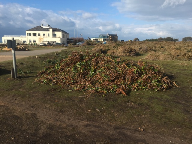
 A pile of hottentot fig, the result of the work of year 6's from St Peter and St Lawrence Primary Schools.
If you spend enough time walking around an area there is a good chance that you will see some fascinating creatures.  This slow worm seemed totally unconcerned about my presence.
  These two Green Lizards were also oblivious of my presence.

Thursday, March 03, 2016

Some more aerial shots

I can never understand why people would ever request an aisle seat on an aircraft as the best entertainment is generally from looking out of the window.  These are a selection of the photographs taken on some recent flights, they certainly provide inspiration for some future kayak trips.
A rather bumpy departure from Jersey, we were quickly into the cloud, re-appearing just before landing at Gatwick.
 My first flight into London City, with the descent taking us close to Dungeness.  A superb example of a cuspate foreland.
 Approaching London from the east, passing over the River Medway, close to Rochester.  One day I must try to visit this area to go sea kayaking.
 Flying over the deserts of the Middle East.  This was on a Qatar Airways A380, which is a great aircraft but not the best for taking photographs from.
 Sunrise over the Loire.  I have paddled on the white water of the Upper Loire but never on this section which is more famous for its Chateaux.  This was an interesting flight as we climbed to 34,000 feet after take off from Toulouse and then dropped down to 24,000 feet just north of Bordeaux and stayed at that height all the way back to Heathrow.  There was no announcement as to why we were flying back at such a low level.
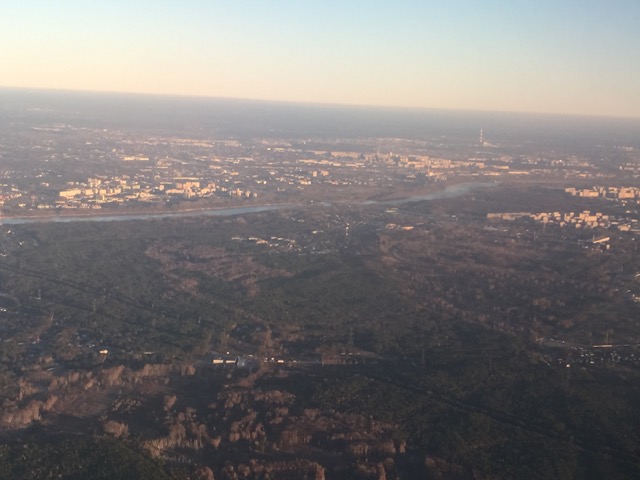
 Late afternoon approach into Warsaw.  The River Vistula is the longest river in Poland.  In the early 1980's I visited one the Canoe Exhibitions at Crystal Palace and came across the International Long River Canoeists Club, an organization run by Peter Salisbury.  He used to produce numerous expedition reports, the first one I bought was his report of paddling down the River Vistula in the 1970's.  I still have it somewhere and must dig out for a read.
Some seats just aren't great for photographs, descending in Jersey we passed over Guernsey with Lihou just visible off the west coast.  I am looking forward to another weekend of paddling off this delightful island in June.
Cowes, on the Isle of Wight.  There were great views as the plane banked as it turned south towards the Channel Islands.

Wednesday, March 02, 2016

Anything but boring

It is obvious that some mountains are more interesting and/or challenging than others and at times the write up they receive in guide books is less than complementary.  Ben Chonzie is one of the mountains which falls into this category. We decided to ignore the written cautions, believing that any mountain in full winter conditions has to be interesting.
As we drove up the narrow Glen Lednock a red kite flew up in from of us, surely a positive omen.  Other people had clearly had the same idea as the small car park was virtually full.  The initial route followed a well defined track which gradually disappeared under a covering of snow.  The snow was largely unconsolidated as we floundered our way uphill.  The thought of breaking a trail through the snow without the benefit of walking poles didn't bear thinking about.
Ben Chonzie is the highest point in a large area of moorland and reputed to have a healthy population of mountain hares, although we didn't see any on our day on the mountain.   Cameron McNeish, in his book on "The Munros", states that it has ".... a reputation of being one of the dullest Munros in the land".  It is easy to imagine that in the summer the long walk in along the land rover track wouldn't be the most interesting way to spend a day in the mountains but on a bright winters day, with the snow down low, then Ben Chonzie (the 250th highest Munro)  is a hill well worth considering.
Beautiful walking conditions.
Cutting a track through the deeper snow, our route had followed the line of the valley , which is discernible behind Nicky. 
Heading up the slopes, using previous footsteps was no guarantee that you wouldn't fall through to your waist.
As we followed the broad ridge towards the summit, snow was blown across the slopes and at times stinging our faces.
On the summit.  It was bitterly cold in the wind so it was a case of a quick sandwich before heading for the shelter of the lower slopes.

Tuesday, March 01, 2016

Memorable Mountain Day

The last few weeks have seen some superb conditions in the Scottish mountains and we were fortunate enough to be able to take advantage of some of them.  There are two mountains, which dominate the A82 above the Bridge of Orchy and are a familiar sight to those people who drive along this trunk road.  Beinn Dorain and Beinn an Dothaidh were selected as our target for the day.
The forecast was perfect for a day in the mountains so it was a matter of packing the rucksacks and heading up.  Conditions couldn't have been much better.
What followed was probably the best day I have ever spent in the mountains in the UK, at least I can't remember any which were better. I suppose any day when you wear crampons for six hours has to be a good day.
 Leaving the Bridge of Orchy.  Our route took us right from the col initially before dropping back down and heading up to the left.
 On the ridge towards the summit of Beinn Dorain.  Views of distant summits were starting to appear.
 Looking along the summit ridge of Beinn an Dothaidh.  At this point the wind had dropped completely. 
 Nicky approaching one of the summits along the ridge.
 We left the summit just after 3.00, we were the only people remaining up apart from one other person heading down the snow slope.  He is the black dot just below the ridge.  Apart from him we had the mountain to ourselves.
 Nicky on the descent.
A summit photo taken by somebody who isn't used to using an iPhone, judging by their finger in the bottom right hand corner.

Monday, February 29, 2016

Breton Canoeing

The forecast for the weekend was pretty dreadful, we were questioning whether the ferry would be able to sail for St Malo, and even more importantly would we be able to get home on the Sunday.  As it was the ferry did sail on the Friday and the sea state was calm enough that most people were able to enjoy a beer or wine on the crossing.
The aim for the weekend was to enjoy a couple of days of canoeing on the inland waterways of Northern Brittany, with a few people having the opportunity to take their 2 Star, mainly as a pre-requisite for their Level 1 coach course in May.  Amazingly two of the people had their 5 Star (Sea) but not their 2 Star.  In Jersey there is no inland water, suitable for paddling, so it is very difficult to get the appropriate experience, you either have to travel off island or we have to start encouraging people to paddle canoes on the sea, something which sits uneasily with me, due to the size of the tides, exposure to swell and changeable weather.
We had arranged to rent canoes from the Canoe Club in Dinan, there were 16 of us and luckily they had 8 canoes in their spacious facilities.  We headed downstream, fully aware that the forecast on French TV was for winds possibly reaching 100 kmh during the afternoon.  Clearly we needed to exercise a degree of caution.
Shelter was found inside a small inlet where it was possible to work on a few skills and also by coincidence to receive a phone call from the ferry company informing us that the sailing on Sunday had been brought forward to hopefully avoid the rapidly deteriorating weather conditions, particularly the increasing wind strength.  We would get home but it meant that there would be no paddling on Sunday.
Lunch was taken further downstream before we had to fight our way back to Dinan.  It was a pleasant contrast to the sea kayaking that we normally experience in Jersey and most of the group felt that we shouldn't leave it too long before returning to France to hone our single blade paddling skills.
 Louis and Lisa getting ready to head downstream.  At this point the wind wasn't too bad.
 We found shelter in a small inlet where we were able to practice a few skills such as rescues, as well as receive a phone call from Condor (the ferry company) that our ferry was leaving earlier on the Sunday due to the strong winds which were forecast.  The main consequence, apart from getting home, was that there would be no paddling on the Sunday.
 Tracey having a go at gunwhale bobbing.  Clearly the days that she spent canoeing down the Yukon has had a significant impact on her skill level.  She looked really competent.
 Once off the water there were a couple of choices, head to the local bar to watch a Six Nations rugby game on the television or head to Decathlon in search of kit.
 Sunday dawned sunny and still, a walk around the walls of St Malo was the option in the time that we had with the forecast of a rapidly increasing wind.
 Once on the ferry we headed out past Cezembre, a small island off the coast of St Malo, which is an interesting place to visit by kayak.
 Le Grand Jardin light marks the entrance channel into St Malo, for us as we headed out to sea it marked the start of a decline in the weather, with an increasing wind and a deteriorating sea state, but at least due to our early departure we made it home.

Tuesday, January 12, 2016

North Wales Wanderings

My Salewa adjustable crampons, which had seen service since 1976, were finally replaced today as I purchased a lovely pair of yellow crampons from the Cotswold Store in Betws Y Coed.  It was clear that there was snow on the mountains but the weather forecast was just abysmal.  It was one of those days when an afternoon with a good book by the fire was preferable to struggling up a wind blasted Welsh mountain side.
Amazingly though the torrential rain, which had been a pouring down for the last couple of hours, stopped as I walked out of the shop and so the reasons for not going on the hill were rapidly disappearing.
I decided to follow the path into Cwm Tryfan, hoping that I would get some shelter from the wind and if at any time the conditions deteriorated too much it would be relatively easy to retrace my steps.  As it turned out I had an interesting few hours and didn't see anybody else all the time I was walking. 
Sadly though I didn't get to use the new crampons.
 Leaving the A5, conditions were really wet under foot but it was clear that there was snow higher up.
 The east face of Tryfan, disappearing into the cloud.
 Looking up towards Glyder Fach
 I headed up this slope to Bwlch Tryfan.  On the way up I has considered crossing the col and heading back to the car by Cwm Bochlwyd but the gusts of wind were so strong I preferred the shelter of my ascent route.

Just starting the descent, back into the relative quiet of Cwm Tryfan, trying to seek some shelter from the strongest gusts of wind.
It almost appeared as if there was some sunshine in the Ogwen Valley but it had certainly disappeared by the time I got there.  Replaced by heavy rain and a howling wind.  It was just past this point that I was blown off my feet by a particularly strong gust.  Time for coffee and cake in Capel Curig.