25 nautical miles west of Corbiere lies the the reef of the Roches Douvres. On clear nights, the white flash every 5 seconds, is visible on the horizon and it had long been an ambition to paddle out there. It was the only part of "Channel Island" waters which I had never visited by sea kayak. It is a long way to go though with obvious escape routes, so ideal conditions and confident partners are required. So when tides and weather seemed to combine to make a visit possible Chris, JR and myself started planning. It was less than 48 hours from conception to departure.
The Roches Douvres was first lit on 15th December 1868 although construction wasn't completed until August 1869. For over 70 years it helped protected mariners operating in the area but the top of the light was blown off by the retreating Germans in August 1944. Reconstruction wasn't completed until 1954, so my understanding is that it was the last major lighthouse to be completed in France.
It was automated in 2000, so we had the reef to ourselves on a perfect June evening. We settled down for an enjoyable bivi prior to an early start the following morning for the return crossing to Jersey.
Approaching the Roche Douvres in near perfect conditions. We felt very isolated at this point. The lighthouse is reputed to be the light which is furthest offshore from mainland Europe. The north Brittany coast was 15 nm to the south.
Three original Nordkapps. Two HM's and one HS. Classic kayaks in magnificent surroundings.
There wasn't much to explore on the reef, but we did climb to the top of the old helicopter landing pad to get a mobile phone signal. It was French, phoning home required an international call.
We prepared for the bivi in almost perfect conditions.
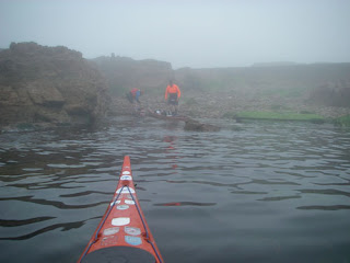
We had woken to clear skies but conditions were deteriorating rapidly. It didn't matter how fast we packed, things weren't going to improve for quite a few hours.
Visibility had dropped significantly in less than 30 minutes. The top of the tower, at 197 feet above sea level, was fast disappearing.
I was afloat first and it quickly became apparent how limited the visibility was. It was obvious that it wasn't going to be a relaxing 25 nm crossing.
Visibility was very limited for the first 4 hours. All we saw was an ice cream container and a dead cormorant. At least it meant we could continue to focus on the GPS. For at least the first hour Ile de Brehat, in France was closer, then for the next hour it was the Hanois, off Guernsey which was closer. Eventually Corbiere became the closest way point. We at least felt that we were on the homeward stretch
Due to the poor visibility we called into Jersey Radio (later changed to Jersey Coast Guard) to inform of our position and to ask for advice regarding the shipping in the area. It was a relief when they called up later to request our position as there was a Condor fast ferry in the area. By this time the visibility had started to improve but it was still a relief to see it pass by.
A welcome sight. Corbiere Lighthouse our final destination after over 5 hours of paddling. As we had managed to maintain a good pace we were back in Jersey in time for lunch and a pint at the Corbiere Phare restuarant and bar.
This paddle was first put on the blog in June 2007.


2 comments:
Wow, what a fantastic trip!
Thanks. It was a memorable paddle. When I see the lighthouse, barely visible on the horizon now. it is hard to imagine that we paddled out there.
Post a Comment